The history of world geography 🌍 traces the development of our understanding of the Earth’s physical features 🌏, the relationships between human populations 👥, and the exploration and mapping 🗺️ of the world. Geography as a discipline has evolved over thousands of years ⏳, shaped by cultural, scientific, and technological advancements. Here’s a detailed look at its historical journey:
🌍 Ancient Beginnings
Geography began as a blend of exploration 🌍, myth, and rudimentary mapping 📜 in ancient times. Early humans were primarily concerned with survival 🏕️, but over time, the need to understand the world around them grew, leading to early geographic thinking.
- Ancient Civilizations (3000 BCE – 500 BCE):
- Mesopotamia: The first known map 🗺️, dating back to around 2300 BCE, was created by the Babylonians, showing their understanding of the surrounding area. The Babylonians used cuneiform to mark important geographical features like rivers 🌊, cities 🏙️, and regions.
- Egypt: Ancient Egyptians developed a deep understanding of their environment 🌾, particularly in relation to the Nile River 🌊, which was essential for agriculture 🌱. The Egyptian maps focused on agricultural zones and flood plains.
- Greek Influence: The Greeks 🇬🇷 were pioneers in the development of geography as a scientific discipline. Hecataeus of Miletus (6th century BCE) is often considered one of the first to describe the world based on empirical observation.
- Pythagoras and Aristotle (4th century BCE) advanced ideas that the Earth 🌍 was spherical, which became a key aspect of geography. Eratosthenes, a Greek scholar, is credited with calculating the Earth’s circumference 🌐 around 240 BCE, making him one of the first to create a world map 🗺️.
🌐 Medieval Period and Islamic Contributions (500 CE – 1500 CE)
- Roman and Byzantine Geography:
- The Roman Empire contributed significantly to mapping and understanding the known world 🌍. Ptolemy, an influential Greek-Roman geographer in the 2nd century CE, created the Geographia, a guide to map-making 🗺️ that included the use of latitude and longitude 📏. His work influenced European map-making for centuries.
- In the Byzantine Empire, geographical knowledge was preserved and expanded, especially through scholars like Cosmas Indicopleustes, who proposed a flat Earth model 🌍, though it was not widely accepted.
- Islamic Golden Age (8th – 14th Century):
- During the medieval period, the Islamic world 🌙 made groundbreaking contributions to geography. Scholars like Al-Idrisi and Ibn Battuta expanded on the ancient Greek and Roman ideas and improved them with their own observations 🔭.
- Al-Idrisi, in the 12th century, created one of the most accurate maps 🌍 of the medieval world, incorporating Africa, Asia, and Europe. His map was used in Europe for several centuries.
- Ibn Battuta, a famous traveler 🚶 and geographer, wrote a detailed account of his travels across the Islamic world 🌍, offering a rich perspective on various regions.
🌍 Age of Exploration (15th – 17th Century)
The Age of Exploration marked a turning point in the history of world geography 🗺️. This period saw Europeans explore new lands 🏝️, trade routes 🚢, and expand their understanding of the globe 🌐.
- Discovery of New Lands:
- In the late 15th century, Christopher Columbus’s voyage 🌊 to the Americas and Vasco da Gama‘s route 🚢 to India opened up new parts of the world 🌎 for European exploration. These discoveries led to the first true representations of the world 🗺️, albeit incomplete.
- Ferdinand Magellan‘s expedition (1519-1522) was the first to circumnavigate the Earth 🌍, proving the spherical nature of the planet 🌐 and adding immensely to geographical knowledge.
- The Development of Maps:
- Early maps, such as those created by Martin Waldseemüller in the early 1500s, began to depict the newly discovered continents 🌎 of the Americas, and these maps were circulated widely throughout Europe.
- Mercator’s Projection (1569) introduced a cylindrical map projection 🗺️ that is still used today, helping navigators plot courses 🚢 on a flat surface while accounting for the spherical Earth 🌍.
🗺️ Scientific Advancements (18th – 19th Century)
- Exploration and Surveying:
- The 18th and 19th centuries saw widespread exploration 🌍 and the beginning of modern geographic techniques. James Cook’s voyages 🌊 to the Pacific Ocean 🌊 and the mapping 🗺️ of Australia and New Zealand provided greater clarity about the southern hemisphere.
- Alexander von Humboldt, a German geographer 🧭, is considered the father of modern geography 🌍. He contributed to the development of climatology 🌡️ and geomorphology 🏞️, focusing on the relationship between physical geography 🗺️ and human activity 👥.
- The Rise of Cartography:
- Advances in surveying, the use of longitude and latitude 📏, and the development of more accurate mapping techniques 🗺️ helped improve the quality and precision of maps 🌍, further enhancing the understanding of the Earth 🌍.
- The invention of the theodolite and sextant in the 18th century allowed explorers to measure their position more accurately than ever before 🔭.
🌎 Modern Geography (20th Century – Present)
In the 20th century, geography developed as an academic discipline 🎓, with a focus on both physical geography (such as landforms 🏞️, climates 🌡️, and ecosystems 🌱) and human geography (such as population 👥, culture 🌍, and urban development 🏙️).
- Technological Advancements:
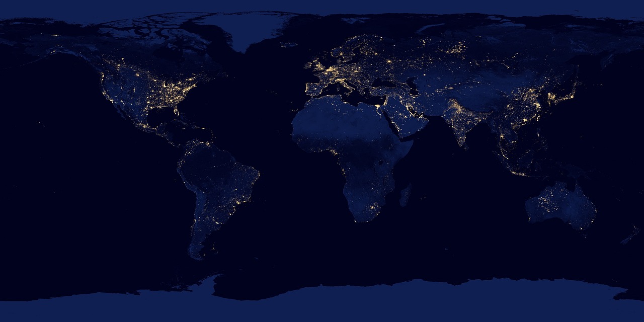
- Satellite imagery 📡 and Geographic Information Systems (GIS) 🌍 revolutionized geography in the late 20th and early 21st centuries. Satellite data provided high-resolution images of the Earth’s surface 🌍, enabling geographers to map even the most remote areas of the world 🌏 accurately.
- The development of GPS technology 📍 and remote sensing allowed for real-time data collection and mapping 🗺️.
- Globalization and Interconnectedness:
- With the advent of globalization 🌐, the world has become increasingly interconnected 🌍, leading to new geographical inquiries into global trade 📦, migration 🚶♂️, urbanization 🏙️, and climate change 🌍.
- Climate change 🌡️ and sustainability 🌱 have become major focuses within geography, as scientists and geographers study human impact on the environment 🌳 and the challenges facing the planet 🌎.
🗺️ Key Moments in Geographic History
- Ancient Egypt (c. 2000 BCE): The first known maps 📜, like the Tabula Rogeriana, depicted the Nile River 🌊 and surrounding areas.
- Eratosthenes (c. 240 BCE): Calculated the Earth’s circumference 🌐 accurately.
- Ptolemy (c. 150 CE): Published the Geographia, incorporating latitude and longitude into map-making 🗺️.
- Age of Exploration (15th-17th centuries): The European Age of Exploration dramatically expanded knowledge of the world 🌎.
- Mercator Projection (1569): Introduced a standardized method for world maps 🗺️.
- Modern Mapping (20th century): The development of GIS, satellite imagery, and GPS revolutionized geography 🌍.
🌐 Conclusion
The history of world geography is a journey from ancient myth and rudimentary maps 📜 to modern scientific understanding of the Earth 🌍. The field continues to evolve with the help of new technologies 🛰️, offering insights into the physical and human dimensions of the world 🌏 we live in. The pursuit of knowledge about our planet 🌍, its resources 🌱, and its inhabitants 👥 remains a key pursuit for geographers today.


